Civic Technology
While major cities have the werewithal to invest in large-scale technological solutions, I wanted to empower smaller to mid-sized cities with the ability to leverage technology on a smaller, faster prototype basis with project-based work with data management provider Stae. The idea is that cities can test out solutions to problems more quickly without having to engage in the procurement process. In this process, city officials become more informed about how to apply IoT sensors, data management layers, and data-driven workflows.
Connected Snow Plows - Jersey City, NJ Office of Innovation

John, Resident Response Coordinator
During snow events, the Resident Response Center in Jersey City was flooded with calls from people, asking where the snow plows were at.
I helped conduct field interviews with the Team to understand their pain points and needs when snow events happened. Based on the interviews with RRC team members and management, I built a GPS tracking device for Snow Plows in Jersey City to inform the team of real-time locations of snow plows and where they’ve been. The RRC also wanted to route questions off the phone to a chatbot service, which I helped build out an integration for. Citizens will be able to query the snow plows in their area to find out basic information such as routes, as well as other city services like courts, and when they can expect their streets to be plowed.
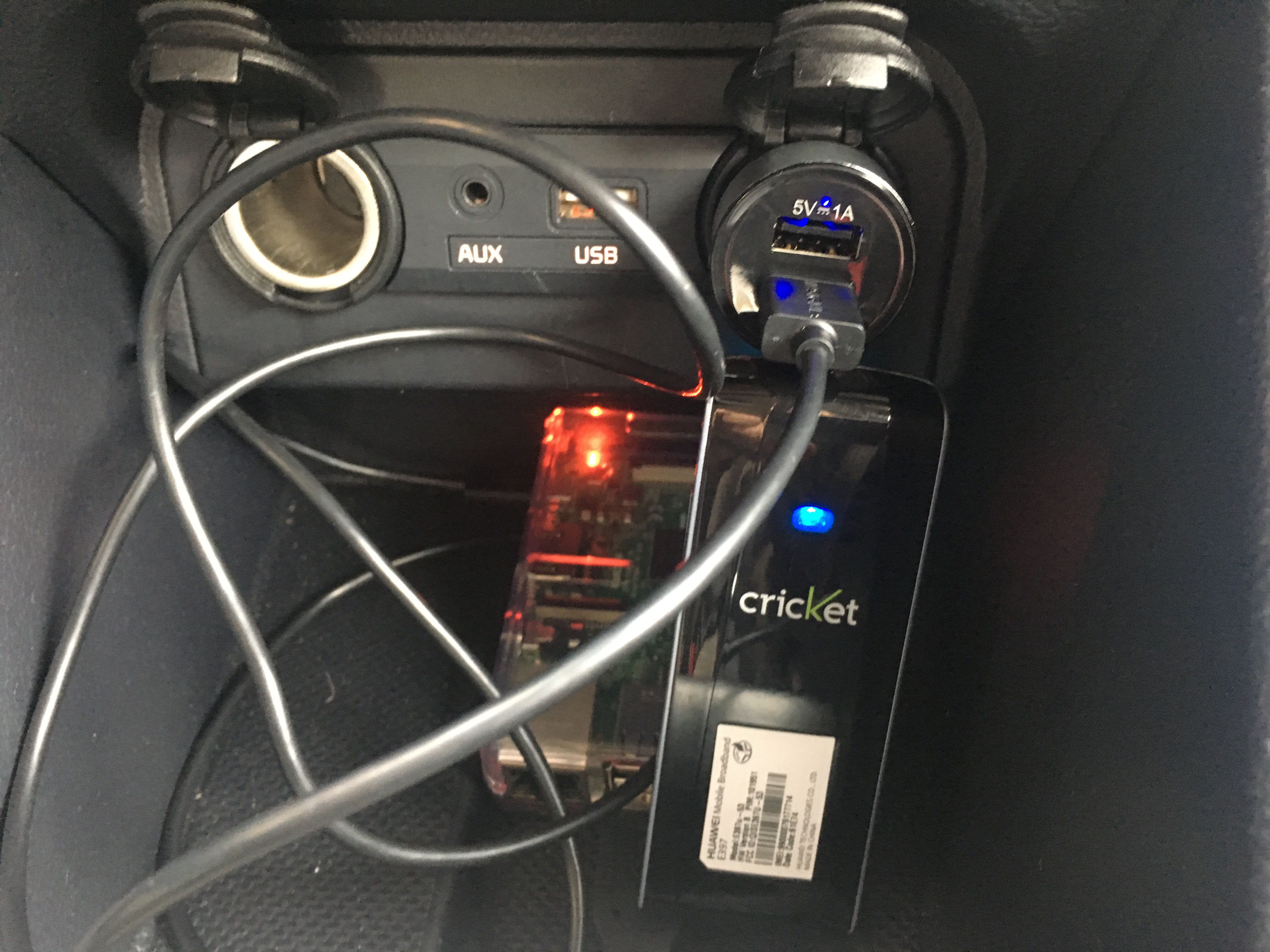
Real-time GPS locations were sent via cellular data over Twilio’s network
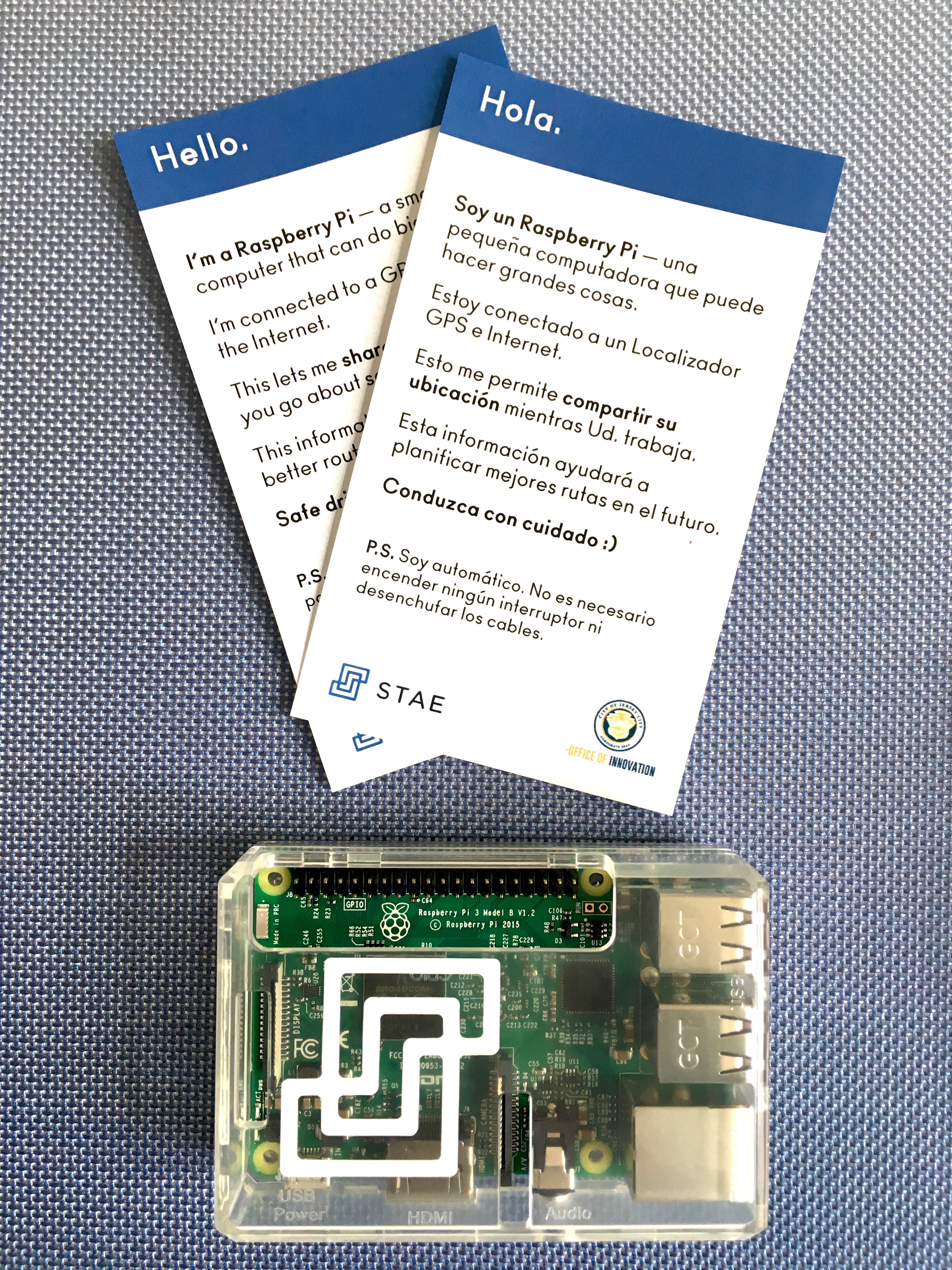
Raspberry Pi set up to push real-time GPS data to Stae and a notecard for vehicle operators to let them how the Pi works and why.
My prototype used off-the-shelf electronics such as Raspberry Pis with Twilio's IoT SIM Cards to send over data to an API over a cellular network. Once the route information was available via API, it could be easily connected to chatbot services or to open source mapping software like Mapbox. Build instructions and case study are provided below.
- Case Study: https://medium.com/city-as-a-service/jersey-city-snow-plows-e4ed5219666c
- Build Instructions: https://cpenalosa.github.io/staeGPS/
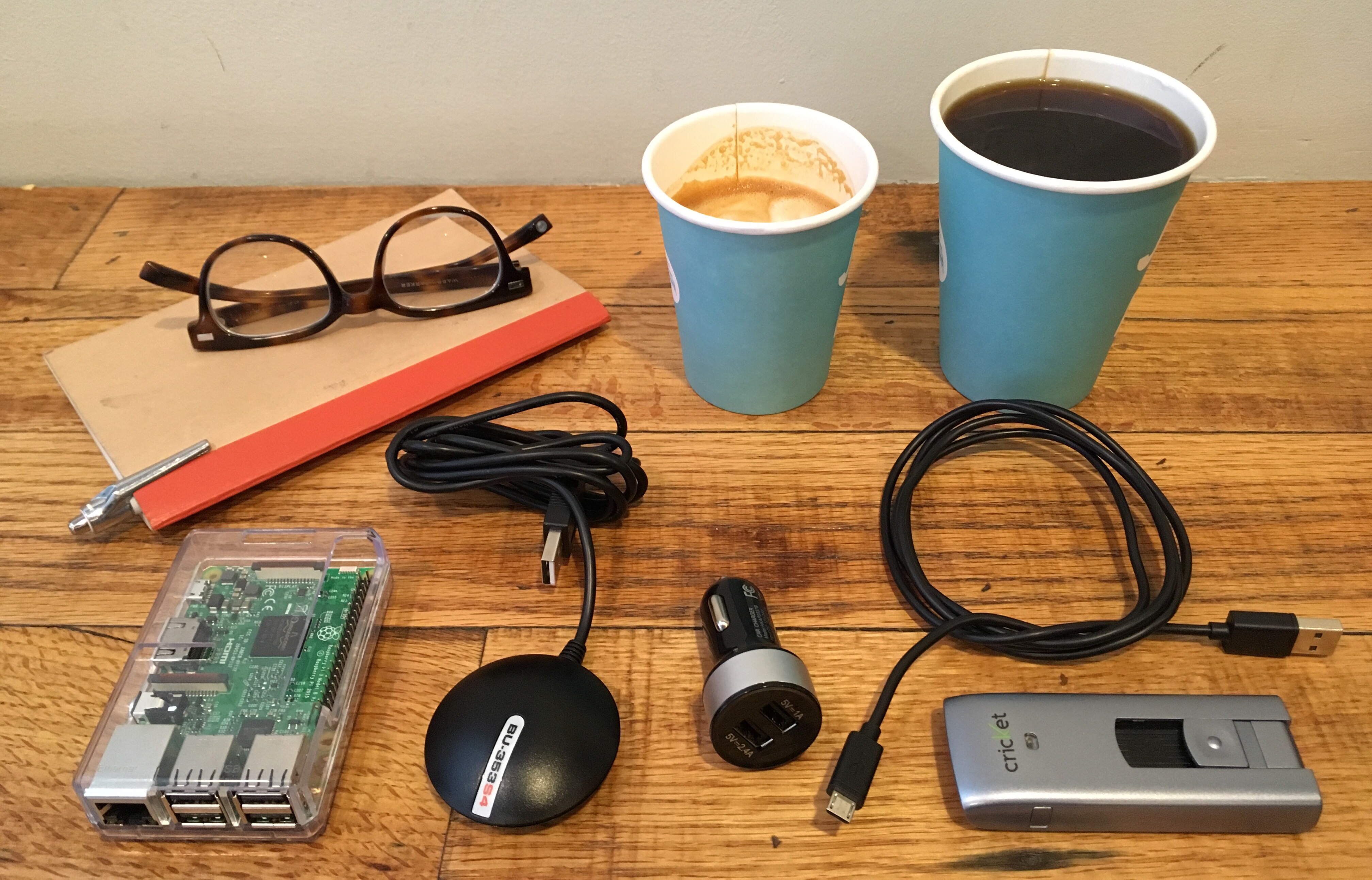
Build materials required for a real-time GPS sensor (coffee optional)
Real-time IoT Sensors: Weather, Parking, and Location data - Evanston, IL
I worked with Evanston's Digital Services team to prototypeseveral IoT sensors including weather and parking sensors. Weather sensor data was used for communication purposes to help the City show beach conditions during the Summer. I also connected an existing weather sensor service they had to a standardized API via Stae, where they could include other city data such as traffic and 311 complaints.
For parking sensors, I used a magnetometer to detect large changes in nearby magnetic fields. When a car parked over the sensor, a change in the sensor's x, y, and z fields were detected and it would send an update to a cloud server that the parking space was occupied. I also used a Hex Display to show a read out of available parking spaces.
One of the deliverables of this work was an educational video explaining on how parking sensors work. In the video, I’m using ultrasonic rangefinder sensors but explain the pros and cons of other approaches. I created this video along with my colleague Adriana at Stae as part of a "How Smart Tech Works" video series.
Parking Sensors Explained from Crystal Penalosa on Vimeo.
Product Documentation and Starter Apps
I built out Stae's Knowledge Base and JS SDK Documentation using sandbox code environments such as Glitch and Observable. During sponsored hackathons, I would assist teams in using the API and mentor them on their response to challenges.- Code Sandbox with JS SDK documentation
https://observablehq.com/@cpenalosa/stae-module-basics -
Starter Apps on Glitch
https://glitch.com/@stae - Stae Knowledge Base https://support.municipal.systems/hc/en-us